In Cumberland about to take off Wednesday morning (albeit 10:40am!):

A photo showing a nicer section of the canal beside us (the trail is also nicer here than was typical):

Taking our first break and Phil looks really mad!

Typical "Hiker - Biker" campsite along the C&O Canal (note: there is also a porta-john out of view):

We had to dodge a lot of mud!

Typical "lock" along the canal with "lockhouse" beside:

More typical conditions of the canal towpath (notice the stagnant water in the canal):

A nice shot of Phil & Mark coming down the trail:

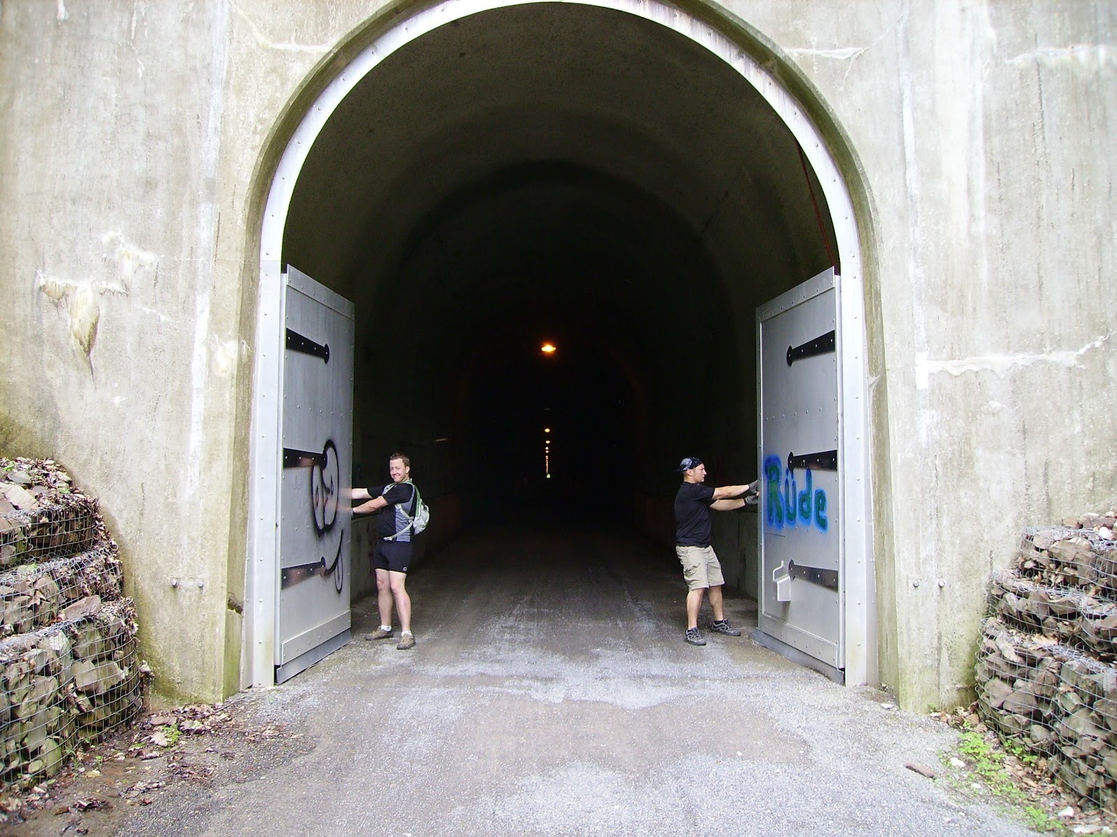
The Paw Paw Tunnel (3,118' long and not lighted):

Using my 3watt LED flashlight to light up the tunnel (that's Phil ahead of me):

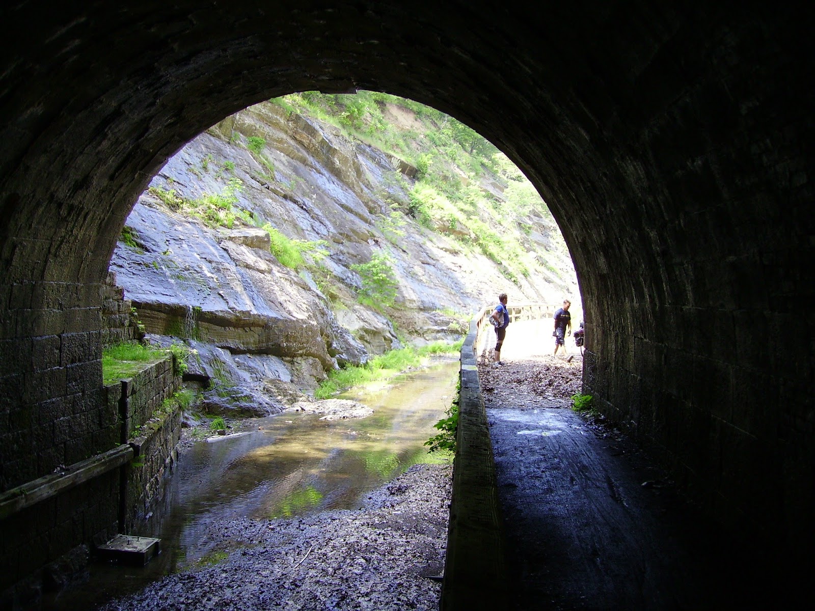
Looking out the other end of the Paw Paw tunnel:
Phil & Mark at the south end of the Paw Paw tunnel:

Mark dropped his trail mix on the ground and is picking it back up to eat later:

Little Orleans Town Directory:

Bill's Place from the outside:

Cool shot speeding down the paved Western MD Rail Trail:

This shot is just cool:

Next morning, Mark trying to cook pancakes (and looking like he's never seen a camera before!):

Overview of our campsite (North Mountain) and yes that is the Potomac River in the background:

Literally riding on the edge of the Potomac River:

Dam #5 just north of Williamsport, MD:

An area of severe washout:

Riding a section with a better view of the Potomac to the right (that's Mark in front of me):

Stopped at Harpers Ferry where the Appalachian Trail crosses paths with the C&O canal:

We setup camp really late Thursday Night. This shot is showing lighting up the campsite with my 3watt LED flashlight:

Phil went to bed early (wuss), but Mark & I stayed up cooking up most of the hot food we had left. Here's a shot showing Mark cooking over the campfire:

Mark's sleeping arrangements. C'mon Mark! Wake up! It's time to go!

We got to historic Whites Ferry and it was closed up and deserted! Notice the flood levels. (My bike in photo):

Zooming along!

Shot of Phil's Bike:

Mark's Bike:

Shot of a restored lock:

At Great Falls (an overlook):

Little further down from Great Falls at a beautiful gorge the river runs through:

Shot of the three of us at the gorge (one of the few shots with me wearing my do rag, but without sunglasses):

Paved bike path along the C&O canal towpath. That paved path will lead you away from the C&O and therefore away from the 0 Mile Marker - beware! It's very tempting to drop down on it!

Coming into Georgetown (D.C.):

Well there's the canal! How do you follow it to the end???

Trying to get to the Waterfront & zero mile marker for the canal:

The three of us at the zero mile marker at the D.C. waterfront:

My bike at the zero mile marker looking toward the Potomac:

My mileage on my odometer (minus .5 miles for the true trip total):

Phil & Mark resting by the first lock (behind them is where you have to ride behind a boat rental business to get to the zero mile marker):

Getting loaded up to leave D.C.

This bike had been locked to a signpost behind where we loaded up. This is why you don't leave your bike unattended in D.C. even if you have it locked up!

Well that's the "best of" of the C&O Canal Towpath section. If I can get around to it I'll be posting one last blog entry: "Tips/Suggestions For Future Riders" for those making the same or a similar trip.